
LIDAR Data Annotation - DataLens Africa
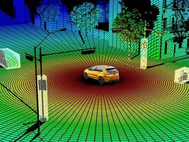
At DataLens Africa, we provide high-precision LIDAR data annotation for 3D perception and spatial AI applications. Our expert annotators specialize in labeling point clouds for autonomous vehicles, robotics, urban planning, and infrastructure mapping. With a focus on African terrain and real-world driving environments, we ensure your models understand complex 3D scenes—from dense urban landscapes to rural and off-road conditions.
Using advanced annotation tools, we deliver 3D bounding boxes, semantic segmentation, object classification, and scene reconstruction with millimeter-level accuracy. Each annotation undergoes multi-stage validation to ensure consistency and reliability. Whether you’re building self-driving cars, drone navigation systems, or smart city solutions, our LIDAR annotation services bring depth, context, and local relevance to your AI.
Learn more about our services: https://datalens.africa/